Bonner County Story Map illustrates growth issues
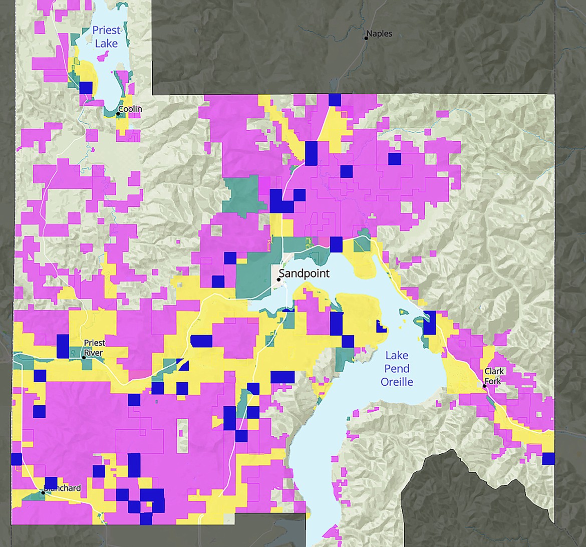
In this screenshot from Project 7B's Story Map website explaining land use and planning issues, the blue shows where zoning changes have occurred since 2019. Yellow shows rural residential zoning districts, pink shows agriculture/forestry zoning districts and green shows higher density land use areas. The group is hosting an online webinar Thursday on land use issues and codes.
(Courtesy illustration)
▶️ Listen to this article now.
Breaking down land-use issues can be difficult.
It’s no easy task to understand the specifics of zoning laws and regulations that govern development. But few pieces of public policy affect residents' day-to-day lives more, Project 7B officials said in announcing a new "Story Map" initiative.
Project 7B officials said they understand how difficult it can be to communicate land-use news to the public. That’s why the organization oversaw the development of the Bonner County Story Map, officials said.
The slickly produced presentation combines graphics and concise facts to detail why the public should care about the county’s planning and zoning policies.
“We wanted to give local residents the necessary background to be more involved in land use planning,” said Susan Drumheller, who helped start Project 7B, a local non-profit whose mission is to promote land use planning based on locally shared values and aspirations.
“We found that the GIS-based Story Map was the perfect visual tool to help explain what is going on,” she said.
The Story Map is being released in time for people to understand the role of the county’s Comprehensive Land Use Plan in advance of the county’s rewrite of the plan, which is expected in 2022.
“We hope this Story Map will help engage the public in shaping the updated plan, which is supposed to lay out the vision for the county’s future growth,” Drumheller said.
The Story Map, produced by Project 7B and Bozeman-based Gage Cartographics, was funded by grants from the Equinox Foundation and Union Pacific Foundation, and individual donors.
The story begins with a brief introduction to the county, underscoring its rural character — a quality that the county’s current Comprehensive Land Use Plan seeks to protect. As the Story Map continues, it explains how the Bonner County Board of Commissioners have made it easier to divide land into higher densities.
The Story Map then breaks down what the area might look like if all private land was broken into smaller parcels. It then touches on the potential impacts of higher-density development in the rural area, such as increased traffic and wildfire risk.
Property and wildfire data for the mapping was sourced from publicly available databases. Some data had to be compiled manually because the county’s online zoning map does not show all the zoning changes in the last two years, which encompasses more than 2,800 acres, according to Project 7B.
To view the Bonner County Story Map, visit Project 7B’s website at Project7B.org or go to storymap.project7b.org.