Crews make gains on fire objectives
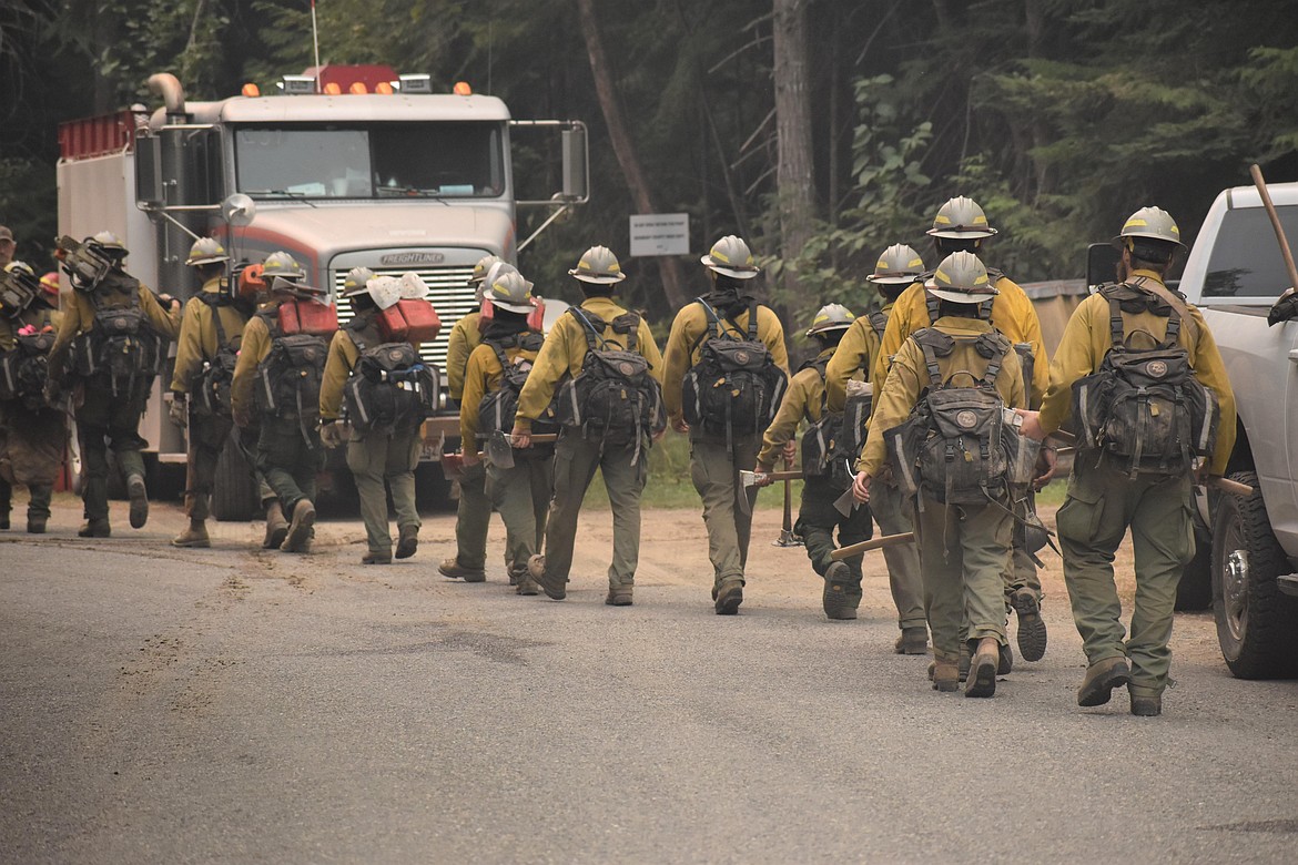
A firefighting crew hikes to a fireline on the Kootenai River Complex.
(Photo courtesy DEANA HARMS/U.S. Forest Service)
BONNERS FERRY — Fire crews are making great strides on incident objections aimed at helping bring the Kootenai River Complex under control, U.S. Forest Service officials said Tuesday.
With 346 fire personnel fighting the fire, completion rate on those objectives have increased to 79%, officials said.
"The completion percentage … represents the rate at which firelines have been completed alongside and using the Westside Road," Forest Service officials said. "A fireline is a line of varying width constructed in the area within or adjacent to the perimeter of an uncontrolled wildfire to create the safest and most effect area where action can be taken to contain the fire."
Yesterday, smoky and hazy skies and light winds kept fire activity minimal on the complex, officials said. Of the fires on the complex, the Russell Mountain and Katka fires are burning at low intensity with backing ground fire moving slowly downhill.
Firefighters are continuing to improve fireline and thin vegetation along Westside Road. They are remaining in place during both the day and night shifts to hold and suppress the fire as it reaches the fireline and Westside Road between Trout Creek and Ball Creek roads.
Because of the cloud cover, the overnight infrared detection flight was unable to fly Monday, resulting in no officials charge in the fires' size.
The Kootenai River Complex is being fought by Type 2 Northern Rockies Incident Management Team 4, with 346 fire crews assigned to the fire.
Columbus and Bear Gulch fires
With the Columbus and Bear Gulch fires crossing into Montana, a coordinated effort is taking place to ensure priorities for both districts are being communicated to the incident commander on scene for unified suppression operations.
Sparked by lightning in late August, the Columbus Fire, located on the Coeur d'Alene River Ranger District, has now burned an estimated 1,806 acres.
The nearby Bear Gulch Fire has burned an estimated 144 acres. Also caused by lightning, the fire is located 6 miles east of Murray.
Both fires are listed as 0% contained.
Diamond Watch Fire
Containment of the Diamond Watch Fire, located 5.5 miles due west of Nordman, remains 49%. Due to the area's rugged, steep and dangerous terrain, the fire is being fought using a contained/confined strategy.
Containment lines have been completed on the west, east and southern edges of the fire and Diamond Creek is acting as a natural barrier on the fire's northern edge.
The fire has burned a total of 957 acres since it was sparked by a lightning strike in mid-July.
Priest Lake Ranger District engine crews are helping assigned firefighters patrol the almost 7 miles of containment lines.
Boulder Mountain Fire
Crews made gains on the Boulder Mountain Fire, bringing containment to 21%, Forest Service officials said. Located on the Colville National Forest, the fire has burned 2,175 acres.
A total of 505 personnel are assigned to the fire, which is impacting a mix of state, federal and private lands in the Tacoma Creek and Boulder Mountain area.
Thor Fire
Now a mix of four fires — Thor, Slate, Salmo and Gypsy Ridge — the fires have burned a combined 2,210 acres with 50 personnel assigned to the fire.
The largest of the fires, the Thor Fire, has burned 1,276 acres; the Slate Fire, 597; Salmo, 320; and Gypsy Ridge, 17.
"The fires are not threatening critical infrastructure, wildlife habitat, nor watershed integrity," Forest Service officials said. "Further trail closures, however, are planned as public safety remains the highest priority."
Closure, evacuations and information
• On the Kootenai River Complex, the following Forest Service trails and roads are closed: Ball Creek Road (FR 432), Trout Creek Road (FR 634), Russell Mountain (No. 12), Russell Ridge (No. 92), Ball and Pyramid Lakes (No. 43), Pyramid Pass (No. 13), Pyramid Peak (No. 7), Fisher Peak (No. 27), Trout Lake (No. 41), McGinty Ridge (No. 143), Clifty Mountain and Clifty/Burrow (No. 182), Myrtle Peak Trail (No. 286), and Burton Peak Trail (No. 9).
Westside Road is limited to residents only. While there are no evacuations in place, those living on Westside Road closest to Ball, Burton and Clark creeks have been upgraded to "set" status under the Ready-Set-Go evacuation procedure.
Under ready, residents are advised to have a plan to evacuate if necessary, while set status asks residents to begin putting their plan into place. Under go status, residents are told to leave immediately due to an imminent threat.
• On the Diamond Watch Fire, closure orders are in effect for Forest Service roads 311, 308, and 1362H in the vicinity of the fire. However, FSR 1362 remains open. Petit Lake and is associated campsites are within the closure area.
Some camping areas along the southwest portion of Sullivan Creek Road have been notified that they are on a “set” be ready evacuation status and should be ready to leave if asked by local authorities.
• On the Thor Fire, roads connecting to the Idaho Panhandle National Forest are closed starting at the junction of FSR 302 and FSR 1013.
• On the Coeur d'Alene Ranger District, closures include Trail 148 along Casper Creek, Trail 7 from the intersection with Trail 774 to Thompson Pass, Trail 1107 near the state line, Trail 763 near the state line, Forest Service Road 938, FSR 430 and FSR 604CZ.
• All methods of travel are prohibited (foot, mechanized, motorized and stock) on the closed roads and area.
• A temporary flight restriction is in place on the Katka Fire as well as on Scotch Creek, Russell Mountain, Eneas Peak and Trout fires. As a reminder, civilian drones are not allowed around active fires. Flying drones near an emergency scene is against the law and forces fire crews to ground their flights.
• A fire watch is in effect through this evening, with dry and unstable weather conditions predicted. In addition, gusty winds and dry conditions are predicted for today.
• Current evacuation status information in Boundary County is available in a recorded message on the Boundary County Emergency Information Line at 208-696-BOCO (2626)
Information: InciWeb.nwcg.gov